![]() |
| |
Übersicht |
|
| |
Areal 0001 (80 Loci) |
|
| |
Areal 6888 (57 Loci) |
|
| |
Areal 6889 (1 Loci) |
|
| |
Areal 6890 (3 Loci) |
|
| |
Areal 6891 (23 Loci) |
|
| |
Areal 6988 (1 Loci) |
|
| |
Areal 6989 (1 Loci) |
|
| |
Areal 6990 (30 Loci) |
|
| |
Areal 6991 (39 Loci) |
|
| |
Areal 7284 (26 Loci) |
|
| |
Areal 7285 (46 Loci) |
|
| |
Areal 7286 (0 Loci) |
|
| |
Areal 7289 (1 Loci) |
|
| |
Areal 7383 (286 Loci) |
|
| |
Areal 7384 (121 Loci) |
|
| |
Areal 7385 (151 Loci) |
|
| |
Areal 7386 (50 Loci) |
|
| |
Areal 7389 (84 Loci) |
|
| |
Areal 7483 (119 Loci) |
|
| |
Areal 7484 (141 Loci) |
|
| |
Areal 7485 (1 Loci) |
|
| |
Areal 7486 (106 Loci) |
|
| |
Areal 7487 (88 Loci) |
|
| |
Areal 7488 (100 Loci) |
|
| |
Areal 7489 (8 Loci) |
|
| |
Areal 7584 (64 Loci) |
|
| |
Areal 7585 (268 Loci) |
|
| |
Areal 7586 (226 Loci) |
|
| |
Areal 7587 (85 Loci) |
|
| |
Areal 7588 (51 Loci) |
|
| |
Areal 7684 (126 Loci) |
|
| |
Areal 7685 (311 Loci) |
|
| |
Areal 7686 (183 Loci) |
|
| |
Areal 7687 (13 Loci) |
|
| |
Areal 7784 (58 Loci) |
|
| |
Areal 7785 (233 Loci) |
|
| |
Areal 7786 (119 Loci) |
|
| |
Areal 7787 (3 Loci) |
|
| |
Areal 7883 (11 Loci) |
|
| |
Areal 7884 (21 Loci) |
|
| |
Areal 7885 (30 Loci) |
|
| |
Areal 7886 (29 Loci) |
|
| |
Areal 7887 (1 Loci) |
|
| |
Areal 7984 (0 Loci) |
|
| |
Areal 7986 (76 Loci) |
|
| |
Areal 7987 (20 Loci) |
|
| |
Areal 8078 (1 Loci) |
|
| |
Areal 8086 (21 Loci) |
|
| |
Areal 8087 (12 Loci) |
|
| |
Areal 8187 (2 Loci) |
|
|
![]() |
|
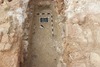
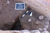
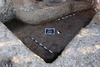
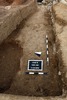
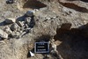
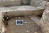
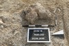
Areal 7685 |
![]() |
|
|
Kontextart |
Einrichtung |
Abschluss |
Höhe |
bis Höhe |
Bild |
|
|
|
Ablagerung |
18.08.2017 |
22.08.2017 |
283.67 |
282.87 |
|
![]() |
![]() |
|
Abtrag (künstlich) |
26.09.2016 |
19.08.2017 |
283.15 |
283.14 |
|
![]() |
![]() |
|
Verfüllung |
26.09.2016 |
22.08.2017 |
283.29 |
282.64 |
|
![]() |
![]() |
|
Versturz |
25.09.2016 |
25.09.2016 |
283.02 |
282.74 |
|
![]() |
![]() |
|
Ablagerung |
25.09.2016 |
08.09.2017 |
282.99 |
282.76 |
|
![]() |
![]() |
|
Boden |
21.09.2016 |
24.09.2016 |
283.09 |
282.99 |
|
![]() |
![]() |
|
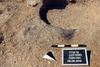
Grube |
21.09.2016 |
|
283.25 |
282.76 |
|
![]() |
![]() |
|
Ablagerung |
21.09.2016 |
21.09.2016 |
283.47 |
283.38 |
|
![]() |
![]() |
|
Ablagerung |
21.09.2016 |
|
283.45 |
|
|
![]() |
![]() |
|
Ablagerung |
20.09.2016 |
|
283.59 |
|
|
![]() |
![]() |
|
Ablagerung |
20.09.2016 |
21.09.2016 |
283.49 |
283.30 |
|
![]() |
![]() |
|
Ablagerung |
17.09.2016 |
24.09.2016 |
283.15 |
282.67 |
|
![]() |
![]() |
|
Verfüllung |
17.09.2016 |
|
283.47 |
|
|
![]() |
![]() |
|
Ablagerung |
15.09.2016 |
27.09.2016 |
283.31 |
283.25 |
|
![]() |
![]() |
|
Ablagerung |
11.09.2016 |
17.09.2016 |
283.44 |
283.07 |
|
![]() |
![]() |
|
Ablagerung |
10.09.2016 |
10.09.2016 |
283.49 |
283.38 |
|
![]() |
![]() |
|
Ablagerung |
09.09.2016 |
16.09.2016 |
283.47 |
283.44 |
|
![]() |
![]() |
|
Ablagerung |
08.09.2016 |
08.09.2016 |
283.13 |
282.94 |
|
![]() |
![]() |
|
Ablagerung |
07.09.2016 |
17.09.2016 |
283.29 |
282.83 |
|
![]() |
![]() |
|
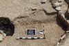
Grube |
07.09.2016 |
07.09.2016 |
283.60 |
283.17 |
|
![]() |
![]() |
|
![]() |
|
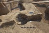
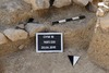
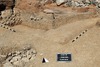
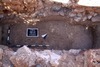
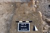
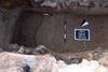
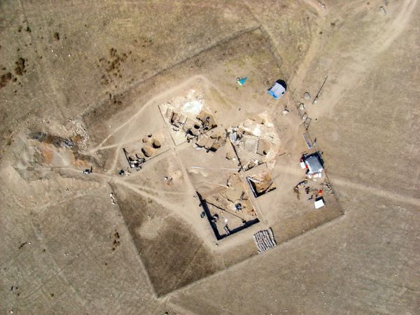
Areal 7685
Der Quadrant befindet sich an der Ostseite des Hügels, d.h. östlich des zentralen Kuppenkomplexes. Im Osten schließt er an Areal 7785 an.
Im nordwestlichen Viertel befindet sich eine Rippe, welche sich vom Zentrum der Nordseite des Quadranten in südwestlicher Richtung durchzieht. Sie verschwindet im Weststeg des Areales. Es handelt sich wahrscheinlich um eine mauerartige Struktur die dem zentralen Kuppenkomplex zugeordnet werden kann. Ihre Fluchtlinien lassen sich an mehreren Stellen auf dem Hügel verfolgen, z.B in Quadrant 7686 und 7687.
Das Gefälle des Quadranten (7685) nimmt nach Norden in Richtung der Rippe ziemlich regelmäßig oder flach zu. Die Oberfläche des Geländes sieht im Allgemeinen ziemlich gerade aus.
Die Oberfläche des Quandranten ist leicht bewachsen (Gräser und Disteln). Es gibt vereinzelte Steinchen und Keramikscherben.
|
|