Ausgrabung  =>  Areal 7685   =>  7685:047

Kontext 7685:047 (Grab: Grabgrube)

Verwaltung


Koordinaten


Einrichtung
Abschluss

30.07.2011
06.08.2011
 

Ost
Nord
Höhe von bis

6.20 bis 8.30
3.50  bis 4.60
283.84  bis 283.66


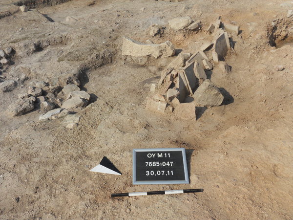
Locus:7685:047 represents the (earthen) pit of tomb Locus:7685:006 .

It contained loose to medium-hard soil. The earth is reddish-brown in color. Among its contents were small to medium-sized chunks of (burnt) mud-brick and (fist-sized) stones. Also found were pieces of charcoal and (small) snail houses (in Erdprobe Fund:7685:047:002 ). Only few (smallish) potsherds came to light. Some bigger pieces may originally have belonged to the tomb (e.g. pithos sherd) proper.


Kollektionen

7685:047:001
7685:047:003
7685:047:004


Seite
2138 von 3468
Areal (Jahr)
alle (alle)
 
Sortierung
kontextid DESC


   Tagesskizzen / Plana
  
  TS-7685-041
  TS-7685-042
  TS-7685-044
 
   Der Locus liegt direkt unter
7685:006   (Grab)


© Oymaagac-Nerik-Forschungsprojekt 2005 - 2011      |      erstellt von datalino 2008 - 2011      |      Kontakt      |      Impressum