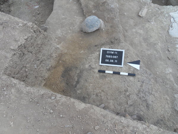
Locus:7685:067 is located south of pit Locus:7685:028 . It constitutes the western continuation of Locus:7685:066 . Locus:7685:067 can probably be identified with a pit, the outer (eastern) edge of which is marked by a large roundish stone (see locus image).
The soil is very loose and is brownish-yellow in color. Moreover, it contains pieces of charcoal and small to medium-sized stones. Little pottery and animal bone were found. Only a few cm of soil could be dug before a hard yellowish surface was reached (cf. bottom of adjacent pit Locus:7685:026 ). This hard surface, as it turned out, can be identified with the top of an unburnt (yellow) mud-brick wall (i.e. wall Locus:7685:080 ).
Pit Locus:7685:067 appears to have been cut by a number of other pits (Locus:7685:026 and Locus:7685:028 ).