Ausgrabung  =>  Areal 7785   =>  7785:179

Kontext 7785:179 (Ablagerung)

Verwaltung


Koordinaten


Einrichtung
Abschluss

07.09.2011
 

Ost
Nord
Höhe von bis

1.20 bis 3.30
7.85  bis 9.90
282.15  bis 282.07


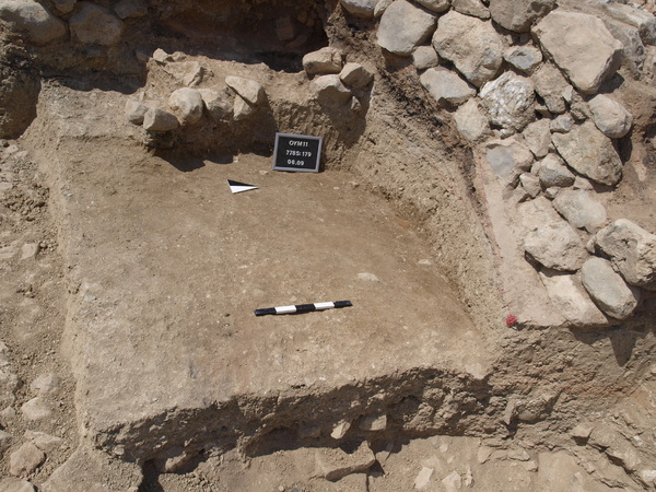
Locus:7785:179 this should have been the reddish layer in the section facing west in the trench but this shows not in reality. The whole area was deepened without any remarkable find other than potsherds and animal bones.
Bottom elevations: sw 282.11, se 282.07, ne 282.09 and nw 282.04 Coordinates East 1.20 till 3.30 and North 7.85 till 9.90.


Kollektionen

7785:179:001
7785:179:002


Seite
1831 von 3468
Areal (Jahr)
alle (alle)
 
Sortierung
kontextid DESC


   Tagesskizzen / Plana
  
  TS-7785-050


© Oymaagac-Nerik-Forschungsprojekt 2005 - 2011      |      erstellt von datalino 2008 - 2011      |      Kontakt      |      Impressum