Ausgrabung  =>  Areal 7786   =>  7786:086

Kontext 7786:086 (Ablagerung)

Verwaltung


Koordinaten


Einrichtung
Abschluss

03.09.2011
 

Ost
Nord
Höhe von bis

2.20 bis 4.10
5.55  bis 7.05
282.74  bis 282.60


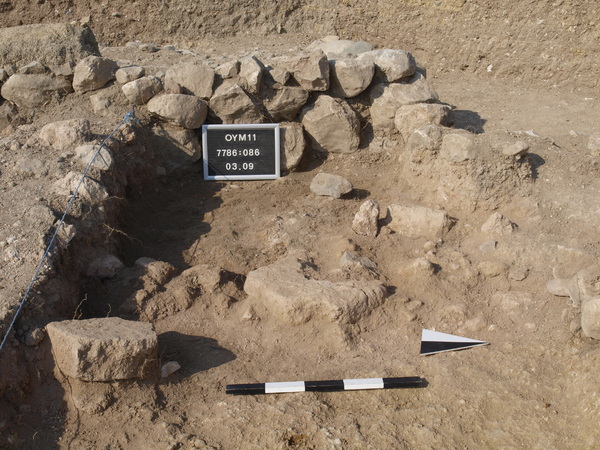
Locus:7786:086 the red burnt mud-brick material, large pieces of bricks in red burnt debris.
Coordinates: East 2.20 till 4.10 and north 5.55 till 7.05. Bottom elevation: 282.


Kollektionen

7786:086:001
7786:086:002


Seite
1857 von 3468
Areal (Jahr)
alle (alle)
 
Sortierung
kontextid DESC


   Tagesskizzen / Plana
  
  TS-7786-028


© Oymaagac-Nerik-Forschungsprojekt 2005 - 2011      |      erstellt von datalino 2008 - 2011      |      Kontakt      |      Impressum