Ausgrabung  =>  Areal 7886   =>  7886:022

Kontext 7886:022 (Ablagerung)

Verwaltung


Koordinaten


Einrichtung
Abschluss

23.07.2013
23.07.2013
 

Ost
Nord
Höhe von bis

8.24 bis 8.65
5.00  bis 5.20
275.48  bis 275.23


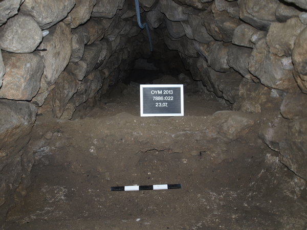
Top of tunnel fill, with lots of pottery, bones and burnt mud-brick. brownish soil. lost of snail remains.
Work stopped by a second 10 o’clock power cut.
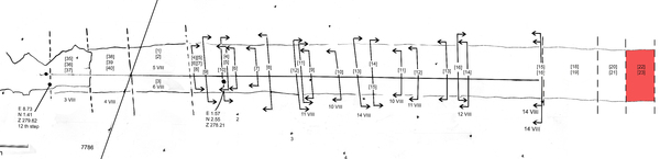
This lasted till 15.00 hours. In the afternoon Theo and some students set up the Total Station and the administrative border between squares 7886 and 7986 was marked in the tunnel by red and white band and a pencil mark on the stone on the right side of the central keystone.
After the return of power some limited digging took place.


Kollektionen

7886:022:001
7886:022:002
7886:022:003


Seite
1731 von 3468
Areal (Jahr)
alle (alle)
 
Sortierung
kontextid DESC


   Tagesskizzen / Plana
  
  Tunnel 19s.jpg


© Oymaagac-Nerik-Forschungsprojekt 2005 - 2011      |      erstellt von datalino 2008 - 2011      |      Kontakt      |      Impressum