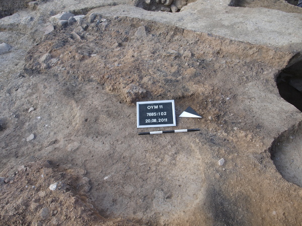
Kontext 7685:102 (Versturz: Mud-brick debris along the east side of wall Locus:7685:038) |
![]() |
Verwaltung |
|
Koordinaten |
![]() |
![]() |
![]() |
Einrichtung
Abschluss |
20.08.2011
20.08.2011 |
|
Ost
Nord
Höhe von bis |
5.60 bis 6.70
2.00 bis 5.00
283.98 bis 283.69
|
|
Layer Locus:7685:102 represents the continuation of (layer) Locus:7685:088 .
It mainly consists of burnt materials, such as potsherds, (small and medium-sized) stones and large chunks of mud-brick. The soil left in place is reddish-brown in color and may be brought into connection with that excavated in conjunction with (layer) Locus:7685:077 , consisting of deteriorated mud-bricks ('Ziegelmehl').
Layer Locus:7685:102 is deposited on top of a semi-hard (greenish-grey) surface (cf. e.g. layer Locus:7685:133 ).
|
| |
|
Kollektionen
|
| |
| |
| |
|
![]() |
|
| |
![]() |
|
2065 von 3544 |
|
Areal (Jahr) |
alle (alle) |
|
Sortierung |
kontextid DESC |
|
|
| |
![]() |
| |
|
|
Tagesskizzen / Plana |
|
|
| |
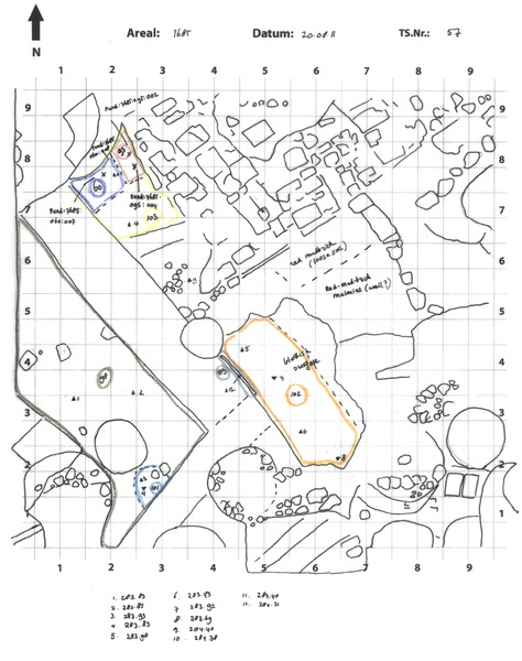
Der Locus liegt direkt unter |
![]() |
![]() |
7685:088 (Versturz) |
![]() |
|
| |
Der Locus liegt direkt über |
![]() |
|
![]() |
|