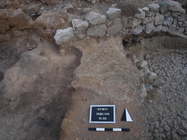
Kontext 7685:140 (Boden: Sloping surface adjacent to wall Locus:7685:045) |
![]() |
Verwaltung |
|
Koordinaten |
![]() |
![]() |
![]() |
Einrichtung
Abschluss |
10.09.2011
09.08.2016 |
|
Ost
Nord
Höhe von bis |
9.10 bis 9.99
7.25 bis 9.00
283.75 bis 283.58
|
|
Surface Locus:7685:140 is a sloping surface that is connected with wall Locus:7685:045 . The corresponding loci in square 7786 are wall Locus:7685:003 and surface Locus:7685:026 .
Surface Locus:7685:140 is located below layer Locus:7685:136 , which may be interpreted as a rubbish deposit.
The surface is very hard in consistency and reddish-grey color.
A characteristic feature of surface Locus:7685:140 is its steep slope. It (max.) drops c. 45 cm (283.75 to 283.30) within c. 1 m.
The surface slopes in the direction of the tunnel. One tentative interpretation is that wall Locus:7685:045 / Locus:7786:003 in combination with layer Locus:7685:140 / Locus:7786:026 functioned as a 'rubbish channel' or sewer used during the Iron Age, thereby accounting for the huge amount of rubbish that was found inside of it (B.C. Coockson).
07:08:2016
Um die Situation in 7685 und die Verbindung zu den Kontexten in 7785 zu klären, tragen wir den Arealsteg zwischen beiden Arealen ab. In diesem Rahmen wird auch die Oberfläche Locus:7685:140 abgetragen.
|
| |
| |
| |
| |
|
![]() |
|
| |
![]() |
|
1885 von 3544 |
|
Areal (Jahr) |
alle (alle) |
|
Sortierung |
kontextid DESC |
|
|
| |
![]() |
| |
|
|
Tagesskizzen / Plana |
|
|
| |
Der Locus liegt direkt unter |
![]() |
![]() |
7685:136 (Ablagerung) |
![]() |
|
| |
Der Locus liegt direkt über |
![]() |
|
![]() |
|