Verwaltung
Koordinaten
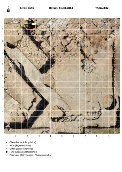
This Locus is defined by being the negavtive impression from the grube consisting of following Loci: Locus:7685:178Locus:7685:179Locus:7685:180Locus:7685:181Locus:7685:183The negative itself is located in the Locus:7685:173 which is also equal to Locus:7685:18416.08.2014 (SR)Durchmesser Oberfläche: max. 85cmDurchmesser max. Ausbauchung: 150 cmTiefe: 115cmForm Oberfläche: (rekonstruiert) kreisrund, ebenForm Querschnitt: GlockeWandung: eingeschnitten in Lehmziegelmauer, klar, hart, fast regelmäßig konvexSohle: fest, nahezu eben, sehr hartInhalt:Locus:7685:092Locus:7685:178Locus:7685:179Locus:7685:180Locus:7685:181Locus:7685:183Erhaltungszustand: gut, Südoberkantenbereich fehltNutzungsphasen: nicht feststellbarVaria: Grube 2011 bis Nordsteg ausgenommen, 2014 dann Bereich unter Steg bearbeitetZeichnung: ArchZ:7685-008