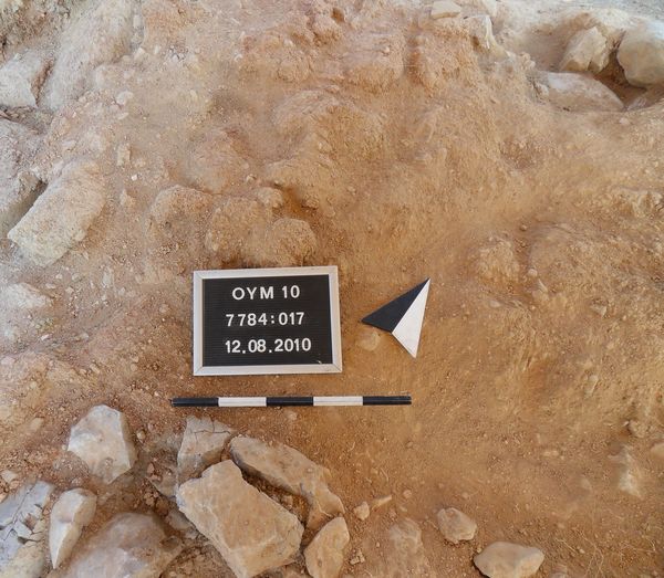
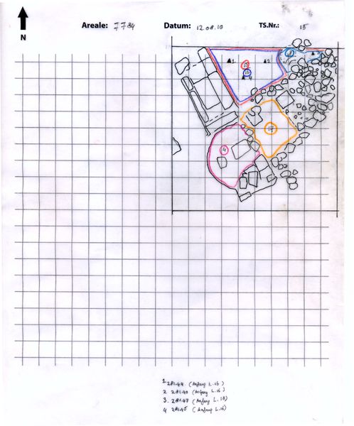
Locus:7784:017 is located adjacent (east) to Locus:7784:004 and west of Locus:7784:025 .
The color of the soil is reddish-brown. The consistency of the soil is medium-loose. It contains small-medium sized stones, chunks of mud-brick, few potsherds and little bone.
Although initially conceived as constituting part of the collapse layer above floor Locus:7784:016 , Locus:7784:017 should, rather, be interpreted as a detoriated mud-brick wall segment. The small stones below the preserved mud-brick structures were used to create a stable foundation for the mud-bricks placed on top (cf. Zusatzbild 13508). A similar situation could be observed in square 7448 (cf. Locus:7488:066 ): a packing of small, partially, burnt stones running below (e.g.) mud-brick wall segment Locus:7488:004 .
Parallels may be drawn with Locus:7885:006 , Locus:7885:007 and Locus:7389:009 . Despite the absence of mud-bricks, in the last case, a layer of small stones is clearly recognizable. Placed in front is a series of large foundation stones. A similar situation could be expected in square 7448, thereby accounting for the seeming lack of small stones on the east side of wall Locus:7488:022 , which are, actually, hidden, it may be hypothesized, behind Locus:7488:083 .