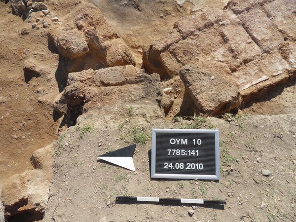
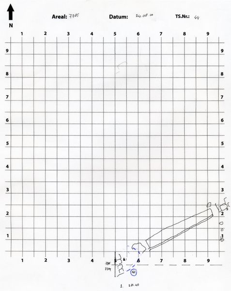
Locus 141 represents the 'pit' in the southwest corner of the square, i.e. where the baulk has been removed (at 5.00 m east).
The pit fill consists of very loose, almost sandy soil, generally reddish-brown in color. Most of it can probably be identified as detoriated mud-brick material (Ziegelmehl). The pit also yielded large chunks of hard-baked mud-brick. One was preserved intact, measuring 50 cm (L) x 21 cm (W) x 15 cm (T).
The pit extends in a northern direction, i.e. the area excavated in 2009. No Locus number is available.
20.08.2015
Bei dem Befund Locus:7785:141 scheint es sich um ein Konglomeratsegment gehandelt zu haben, welches aufgrund von Fehlinterpretation als Grube abgebaut wurde. Das Konglomerat scheint überwiegend Lehmziegeln und Lehmziegelschutt und nur vereinzelt kleinere Steine anthalten zu haben.