Ausgrabung  =>  Areal 7785   =>  7785:166

Kontext 7785:166 (Ablagerung)

Verwaltung


Koordinaten


Einrichtung
Abschluss

01.09.2011
 

Ost
Nord
Höhe von bis

0.50 bis 3.55
6.15  bis 9.99
282.63  bis 282.60


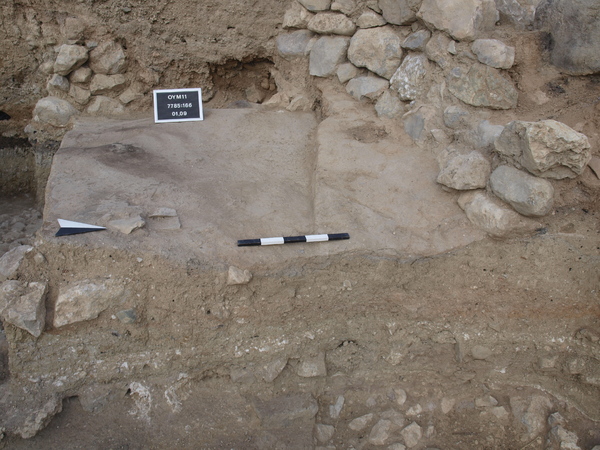
Locus:7785:166 this is the surface left in 2009. In this surface the potholes were found. The material is a hard grey clay with some red burnt mud material in it. Top elevations: sw 282.63, nw 282.75, n-middle 282.58, s middle 282.67, ne 282.50 and se 282.56 Bottom elevations: sw 282.60, nw top of stone 282.77, n middle 282.57, s middle 282.61, ne 282.44 and se 282.53.
Coordinates: east 0.50 till 3.55, North 6.15 till 9.99.


Kollektionen

7785:166:001
7785:166:002


Seite
1878 von 3468
Areal (Jahr)
alle (alle)
 
Sortierung
kontextid DESC


   Tagesskizzen / Plana
  
  TS-7785-047


© Oymaagac-Nerik-Forschungsprojekt 2005 - 2011      |      erstellt von datalino 2008 - 2011      |      Kontakt      |      Impressum