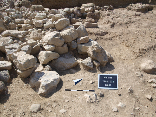
Locus:7786:075 : The wall Locus:7786:015 ends in the east in a very irregular way. This is probably the result of the erosion. The lowest course of the wall surfaces in the slope. This the yellow hard material of the slope a grayish long ditch is visible in the section of the ‘deep sounding’ as well as in the surface of the trench. The end of [15] was set out by wire and became Locus:7786:075. Here the grey soil was removed and small stones and a few new very large ones appeared. The wall [15] continued to the east line of this grey ditch. This ditch Locus:7786:045 is filled with a thick layer of small stones and pebbles. The original foundation trench for wall [15] is clearly visible after scraping the soil, a dark brown trench fill in a yellow-brownish surrounding. The south wall line is almost straight and makes a 90 degree corner towards the north.
The elevations of this locus start at 282.65 W, 281.88 E , and its bottom level is 281.83 E. Coordinates East: 6.85. till 6.20, North: 3.10 till 5.20.