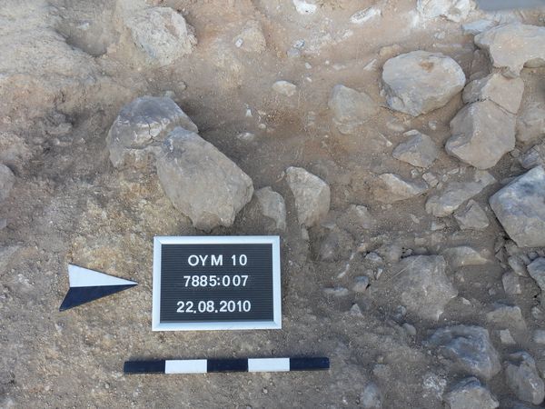
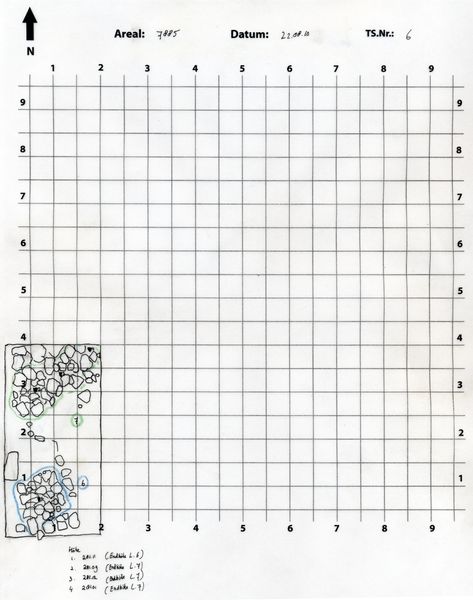
Locus:7885:006 and Locus:7885:007 were initially interpreted as pits. This view was based on the loose nature of the soil.
However, while excavating Locus:7885:007 and Locus:7885:006 it soon became apparent that a clear outline could not be established. Moreover, the alleged bottom of the pit consisted of a good many stones, some of which clearly lay in a parallel fashion and could later be interpreted as belonging to wall Locus:7785:072 and/or Locus:7785:073 (or Locus:7885:009 ?) .
The 'pit' also yielded a large number of small, blackened stones, which can probably be interpreted as foundation stones, creating a horizontal surface on top of which a mud-brick superstructure would have been placed. Hence, the reddish collapse material, constituting the alleged dirt fill of pit Locus:7885:006 , should rather be interpreted as representing the extant remains of the original mud-brick superstructure.
A similar explanation is given for Locus:7885:006.