![]() |
| |
Übersicht |
|
| |
Areal 0001 (80 Loci) |
|
| |
Areal 6888 (57 Loci) |
|
| |
Areal 6889 (1 Loci) |
|
| |
Areal 6890 (3 Loci) |
|
| |
Areal 6891 (23 Loci) |
|
| |
Areal 6988 (1 Loci) |
|
| |
Areal 6989 (1 Loci) |
|
| |
Areal 6990 (30 Loci) |
|
| |
Areal 6991 (39 Loci) |
|
| |
Areal 7284 (26 Loci) |
|
| |
Areal 7285 (46 Loci) |
|
| |
Areal 7286 (0 Loci) |
|
| |
Areal 7289 (1 Loci) |
|
| |
Areal 7383 (286 Loci) |
|
| |
Areal 7384 (121 Loci) |
|
| |
Areal 7385 (151 Loci) |
|
| |
Areal 7386 (50 Loci) |
|
| |
Areal 7389 (84 Loci) |
|
| |
Areal 7483 (119 Loci) |
|
| |
Areal 7484 (141 Loci) |
|
| |
Areal 7485 (1 Loci) |
|
| |
Areal 7486 (106 Loci) |
|
| |
Areal 7487 (88 Loci) |
|
| |
Areal 7488 (100 Loci) |
|
| |
Areal 7489 (8 Loci) |
|
| |
Areal 7584 (64 Loci) |
|
| |
Areal 7585 (268 Loci) |
|
| |
Areal 7586 (226 Loci) |
|
| |
Areal 7587 (85 Loci) |
|
| |
Areal 7588 (51 Loci) |
|
| |
Areal 7684 (126 Loci) |
|
| |
Areal 7685 (311 Loci) |
|
| |
Areal 7686 (183 Loci) |
|
| |
Areal 7687 (13 Loci) |
|
| |
Areal 7784 (58 Loci) |
|
| |
Areal 7785 (233 Loci) |
|
| |
Areal 7786 (119 Loci) |
|
| |
Areal 7787 (3 Loci) |
|
| |
Areal 7883 (11 Loci) |
|
| |
Areal 7884 (21 Loci) |
|
| |
Areal 7885 (30 Loci) |
|
| |
Areal 7886 (29 Loci) |
|
| |
Areal 7887 (1 Loci) |
|
| |
Areal 7984 (0 Loci) |
|
| |
Areal 7986 (76 Loci) |
|
| |
Areal 7987 (20 Loci) |
|
| |
Areal 8078 (1 Loci) |
|
| |
Areal 8086 (21 Loci) |
|
| |
Areal 8087 (12 Loci) |
|
| |
Areal 8187 (2 Loci) |
|
|
![]() |
|
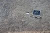
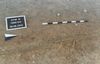
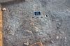
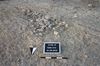
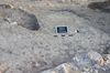
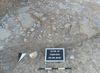
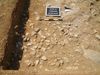
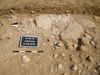
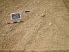
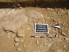
Areal 7389 |
![]() |
|
|
Kontextart |
Einrichtung |
Abschluss |
Höhe |
bis Höhe |
Bild |
|
|
|
Ablagerung |
12.08.2010 |
12.08.2010 |
283.56 |
283.39 |
|
![]() |
![]() |
|
Grube |
12.08.2010 |
13.08.2010 |
282.84 |
282.52 |
|
![]() |
![]() |
|
Ablagerung |
11.08.2010 |
|
283.12 |
|
|
![]() |
![]() |
|
Grube |
10.08.2010 |
13.08.2010 |
282.95 |
282.38 |
|
![]() |
![]() |
|
Grube |
10.08.2010 |
11.08.2010 |
283.45 |
283.22 |
|
![]() |
![]() |
|
Grube |
10.08.2010 |
11.08.2010 |
282.97 |
282.20 |
|
![]() |
![]() |
|
Grube |
07.08.2010 |
|
282.66 |
|
|
![]() |
![]() |
|
Grube |
07.08.2010 |
07.08.2010 |
282.60 |
282.22 |
|
![]() |
![]() |
|
Ablagerung |
07.08.2010 |
|
283.38 |
|
|
![]() |
![]() |
|
Grube |
07.08.2010 |
11.08.2010 |
282.61 |
282.21 |
|
![]() |
![]() |
|
Oberfläche |
06.08.2010 |
|
282.60 |
|
|
![]() |
![]() |
|
Grab |
06.08.2010 |
18.08.2010 |
282.50 |
282.27 |
|
![]() |
![]() |
|
Grab |
06.08.2010 |
|
283.20 |
282.80 |
|
![]() |
![]() |
|
Ablagerung |
06.08.2010 |
19.08.2010 |
283.37 |
282.95 |
|
![]() |
![]() |
|
Ablagerung |
05.08.2010 |
05.08.2010 |
283.66 |
283.40 |
|
![]() |
![]() |
|
Installation |
03.08.2010 |
|
283.90 |
|
|
![]() |
![]() |
|
Mauer |
03.08.2010 |
|
283.59 |
|
|
![]() |
![]() |
|
Ablagerung |
03.08.2010 |
08.08.2010 |
283.46 |
282.05 |
|
![]() |
![]() |
|
Ablagerung |
03.08.2010 |
|
282.94 |
|
|
![]() |
![]() |
|
Mauer |
01.08.2010 |
|
283.78 |
|
|
![]() |
![]() |
|
![]() |
|
![]() |
|
![]() |
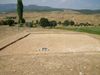
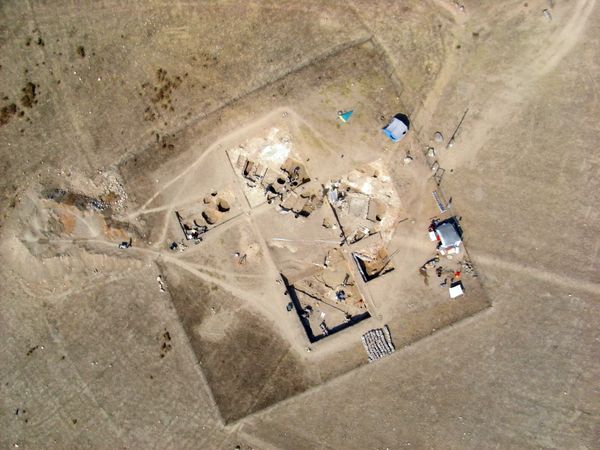
Areal 7389
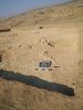
Der Quadrant 7389 befindet sich im nordöstlichen Bereich des Hügels, von der Hügelspitze liegt er jedoch in nordwestlicher Richtung, in ca. 30m Entfernung. Der höchste Punkt ist sein sö-licher Eckpunkt, von dem aus man kaum noch auf die Hügelspitze sehen kann. Das Gelände fällt recht regelmäßig flachschräg nach Nordwesten ab, der tiefste Punkt ist der NW-Eckpunkt. Vom Quadranten bietet sich ein sehr schöner, hervorragender Blick über das nördliche Vezirköprü Ovası bis in die Berge im Norden und einen Ausläufer des Altınkaya-Stausees.
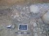
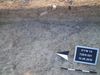
Die unbearbeitete Oberfläche zeigt sich dicht bewachsen mit bis zu 70cm hohen Disteln und widerständigen Gräsern, auch kleinere und bunt blühende Pflanzen gedeihen, der harte Boden ist bedeckt von trockenen und vertrockneten Gräsern. Der Bewuchs indiziert keinerlei Strukturen. Auf der Oberfläche finden sich keine Scherben und keine Knochen, dafür ist die Konzentration an meist faustgroßen, selten bis zu 15cm großen Steinen mit ca 25 Stück pro Qm recht hoch. Vereinzelt finden sich gelbe Lehmziegelbruchstücke.
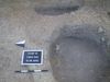
Die Geophysik zeigt im SO einen Gebäudeteil, wahrscheinlich eine von NO nach SW verlaufende Mauer. Der große Teil des Quadranten liegt außerhalb des Gebäudes.
|
|