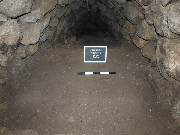
This layer 7886:019 has the same dimensions as locus 7886:018 and runs all the way down to the stairs surface at the bottom level in this locus.
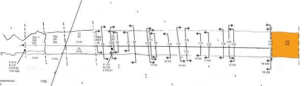
Step30 is the last step with stones in place; 3 stones are placed starting on the North side or 'left' wall. There are some open places between the stones and the connection with the South or right wall is missing. Elevation middle stone 275.77. The distance between the top of the step and the ceiling is 175 cm.
This bottom layer of locus 7886:019 which was once step 31 however it consists not of the expected stone step like higher up in the tunnel but this first newly excavated step is a thick sticky light brown clay layer with smaller stones that seem to have been the bedding on which the large stones of the step were placed. The elevation in the middle is 275.45. The distance between the step and the ceiling is 190 cm.
The next step down (nr 32) shows as the flat cut, white bed-rock; no indications that this ever had a stone surface.
This step became a bit rounded in the middle where it was worn by walking up and down the steps.
The start of the unpaved steps coincides with the appearance of the white bed-rock surface on which the south wall is standing. This is at the level of step 30-31 at an elevation of circa 275.50.